
- Start >
- Groundwater >
- Waterlevel of upper layer >
- Inn >
- KUTTERLINGERWEG KO 38 >
- Chart of total period

Chart of total period KUTTERLINGERWEG KO 38
Groundwater levels of the total period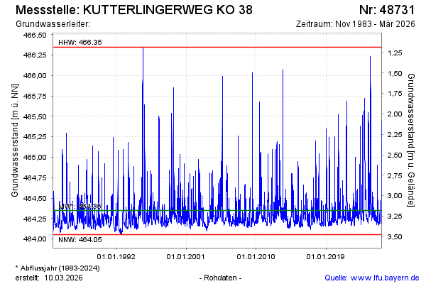
Groundwater level [m above sealevel]: 464.26
Distance to surface [m]: 3.27
Last value from 19.02.2025 10:41
Ground level [m above sealevel]: 467.53
| Date | Groundwater level [m above sealevel] |
|---|---|
| 19.02.2025 | 464.25 |
| 18.02.2025 | 464.26 |
| 17.02.2025 | 464.26 |
| 16.02.2025 | 464.27 |
| 15.02.2025 | 464.27 |
| 14.02.2025 | 464.28 |
| 13.02.2025 | 464.28 |
| 12.02.2025 | 464.29 |
© Bayerisches Landesamt für Umwelt 2025