
- Start >
- Groundwater >
- Waterlevel of upper layer >
- Inn >
- LEDERHUB A 860 >
- Current data

Current data LEDERHUB A 860
Groundwater levels of the last 12 months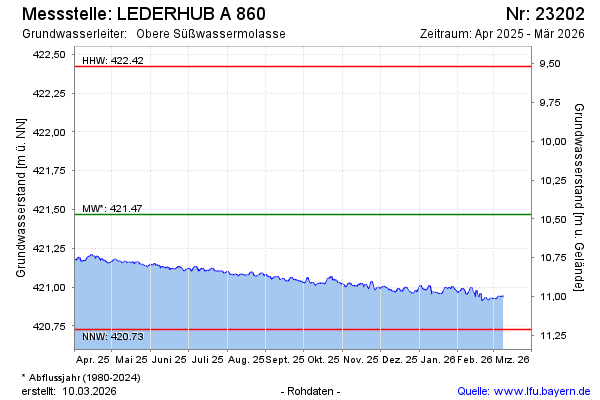
Groundwater level [m above sealevel]: 421.13
Distance to surface [m]: 10.81
Last value from 05.02.2025 11:56
Ground level [m above sealevel]: 431.94
| Date | Groundwater level [m above sealevel] |
|---|---|
| 05.02.2025 | 421.14 |
| 04.02.2025 | 421.15 |
| 03.02.2025 | 421.16 |
| 02.02.2025 | 421.17 |
| 01.02.2025 | 421.16 |
| 31.01.2025 | 421.15 |
| 30.01.2025 | 421.18 |
| 29.01.2025 | 421.19 |
© Bayerisches Landesamt für Umwelt 2025