
- Start >
- Groundwater >
- Waterlevel of upper layer >
- Inn >
- MIETRACHING R 13 >
- Chart of total period

Chart of total period MIETRACHING R 13
Groundwater levels of the total period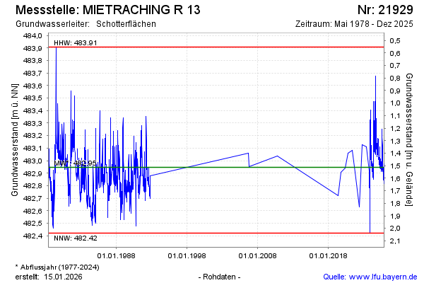
Groundwater level [m above sealevel]: 482.99
Distance to surface [m]: 1.47
Last value from 05.03.2025 12:26
Ground level [m above sealevel]: 484.46
| Date | Groundwater level [m above sealevel] |
|---|---|
| 05.03.2025 | 482.98 |
| 04.03.2025 | 482.98 |
| 03.03.2025 | 482.99 |
| 02.03.2025 | 482.99 |
| 01.03.2025 | 483.00 |
| 28.02.2025 | 483.01 |
| 27.02.2025 | 483.01 |
| 26.02.2025 | 483.01 |
© Bayerisches Landesamt für Umwelt 2025