
- Start >
- Groundwater >
- Waterlevel of upper layer >
- Inn >
- N10 - HWS Mörnbach >
- Chart of total period

Chart of total period N10 - HWS Mörnbach
Groundwater levels of the total period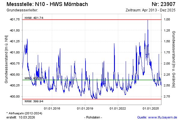
Groundwater level [m above sealevel]: 400.40
Distance to surface [m]: 2.35
Last value from 13.03.2025 10:00
Ground level [m above sealevel]: 402.75
| Date | Groundwater level [m above sealevel] |
|---|---|
| 31.12.2024 | 400.65 |
| 30.12.2024 | 400.66 |
| 29.12.2024 | 400.68 |
| 28.12.2024 | 400.69 |
| 27.12.2024 | 400.70 |
| 26.12.2024 | 400.72 |
| 25.12.2024 | 400.73 |
| 24.12.2024 | 400.75 |
© Bayerisches Landesamt für Umwelt 2025