
- Start >
- Groundwater >
- Waterlevel of upper layer >
- Inn >
- OBERADLFURT R 42 >
- Chart of total period

Chart of total period OBERADLFURT R 42
Groundwater levels of the total period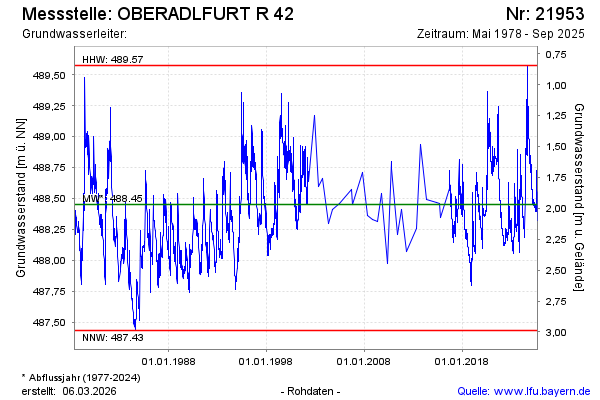
Groundwater level [m above sealevel]: 488.66
Distance to surface [m]: 1.76
Last value from 06.02.2025 09:00
Ground level [m above sealevel]: 490.42
| Date | Groundwater level [m above sealevel] |
|---|---|
| 06.02.2025 | 488.66 |
| 05.02.2025 | 488.66 |
| 04.02.2025 | 488.67 |
| 03.02.2025 | 488.69 |
| 02.02.2025 | 488.70 |
| 01.02.2025 | 488.71 |
| 31.01.2025 | 488.73 |
| 30.01.2025 | 488.75 |
© Bayerisches Landesamt für Umwelt 2025