
- Start >
- Groundwater >
- Waterlevel of upper layer >
- Inn >
- OED/MEHRING 576 >
- Chart of total period

Chart of total period OED/MEHRING 576
Groundwater levels of the total period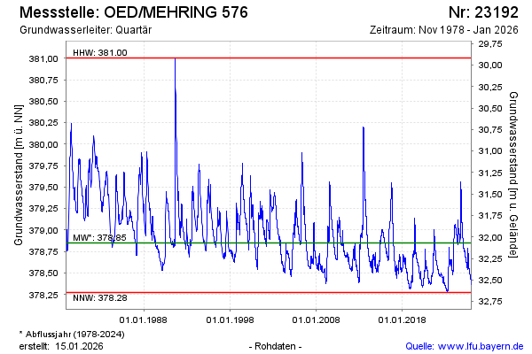
Groundwater level [m above sealevel]: 378.79
Distance to surface [m]: 32.13
Last value from 15.02.2025 09:00
Ground level [m above sealevel]: 410.92
| Date | Groundwater level [m above sealevel] |
|---|---|
| 15.02.2025 | 378.79 |
| 14.02.2025 | 378.79 |
| 13.02.2025 | 378.79 |
| 12.02.2025 | 378.79 |
| 11.02.2025 | 378.80 |
| 10.02.2025 | 378.80 |
| 09.02.2025 | 378.80 |
| 08.02.2025 | 378.80 |
© Bayerisches Landesamt für Umwelt 2025