
- Start >
- Groundwater >
- Waterlevel of upper layer >
- Inn >
- REISCHACH 805 >
- Current data

Current data REISCHACH 805
Groundwater levels of the last 12 months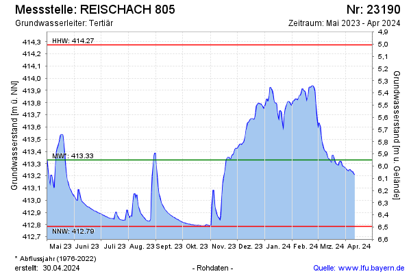
Groundwater level [m above sealevel]: 413.61
Distance to surface [m]: 5.67
Last value from 05.02.2025 12:12
Ground level [m above sealevel]: 419.28
| Date | Groundwater level [m above sealevel] |
|---|---|
| 05.02.2025 | 413.62 |
| 04.02.2025 | 413.66 |
| 03.02.2025 | 413.69 |
| 02.02.2025 | 413.71 |
| 01.02.2025 | 413.72 |
| 31.01.2025 | 413.73 |
| 30.01.2025 | 413.74 |
| 29.01.2025 | 413.74 |
© Bayerisches Landesamt für Umwelt 2025