
- Start >
- Groundwater >
- Waterlevel of upper layer >
- Inn >
- Reischach B1 >
- Current data

Current data Reischach B1
Groundwater levels of the last 12 months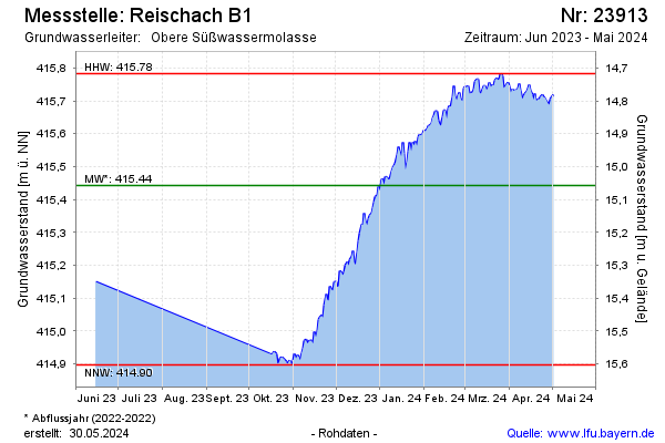
Groundwater level [m above sealevel]: 415.88
Distance to surface [m]: 14.62
Last value from 05.02.2025 12:40
Ground level [m above sealevel]: 430.50
| Date | Groundwater level [m above sealevel] |
|---|---|
| 05.02.2025 | 415.88 |
| 04.02.2025 | 415.89 |
| 03.02.2025 | 415.90 |
| 02.02.2025 | 415.91 |
| 01.02.2025 | 415.90 |
| 31.01.2025 | 415.88 |
| 30.01.2025 | 415.89 |
| 29.01.2025 | 415.89 |
© Bayerisches Landesamt für Umwelt 2025