
- Start >
- Groundwater >
- Waterlevel of upper layer >
- Inn >
- SCHLARBHOFEN 16 >
- Current data

Current data SCHLARBHOFEN 16
Groundwater levels of the last 12 months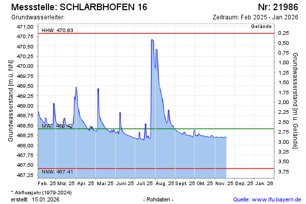
Groundwater level [m above sealevel]: 468.46
Distance to surface [m]: 2.63
Last value from 19.02.2025 11:00
Ground level [m above sealevel]: 471.09
| Date | Groundwater level [m above sealevel] |
|---|---|
| 19.02.2025 | 468.47 |
| 18.02.2025 | 468.48 |
| 17.02.2025 | 468.50 |
| 16.02.2025 | 468.54 |
| 15.02.2025 | 468.56 |
| 14.02.2025 | 468.67 |
| 13.02.2025 | 468.68 |
| 12.02.2025 | 468.57 |
© Bayerisches Landesamt für Umwelt 2025