
- Start >
- Groundwater >
- Waterlevel of upper layer >
- Inn >
- UMSPANNWERK PANG 13 >
- Current data

Current data UMSPANNWERK PANG 13
Groundwater levels of the last 12 months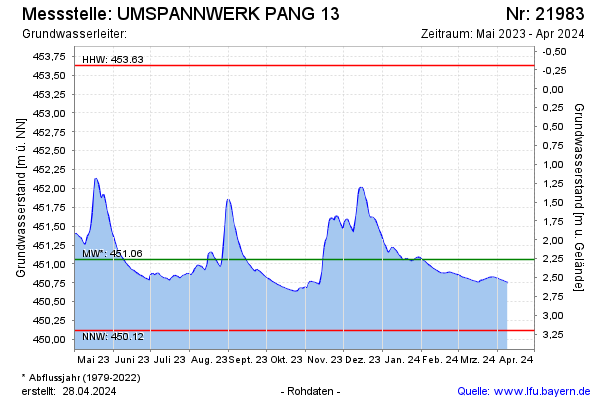
Groundwater level [m above sealevel]: 450.81
Distance to surface [m]: 2.51
Last value from 18.02.2025 15:27
Ground level [m above sealevel]: 453.32
| Date | Groundwater level [m above sealevel] |
|---|---|
| 18.02.2025 | 450.80 |
| 17.02.2025 | 450.81 |
| 16.02.2025 | 450.81 |
| 15.02.2025 | 450.82 |
| 14.02.2025 | 450.82 |
| 13.02.2025 | 450.82 |
| 12.02.2025 | 450.83 |
| 11.02.2025 | 450.83 |
© Bayerisches Landesamt für Umwelt 2025