
- Start >
- Groundwater >
- Waterlevel of upper layer >
- Inn >
- UNT.-HEUFELD R 32 >
- Chart of total period

Chart of total period UNT.-HEUFELD R 32
Groundwater levels of the total period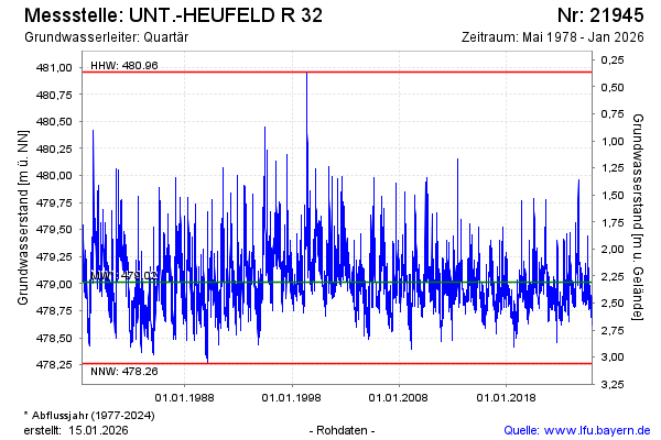
Groundwater level [m above sealevel]: 478.86
Distance to surface [m]: 3.05
Last value from 18.02.2025 07:00
Ground level [m above sealevel]: 481.91
| Date | Groundwater level [m above sealevel] |
|---|---|
| 17.02.2025 | 478.87 |
| 16.02.2025 | 478.86 |
| 15.02.2025 | 478.85 |
| 14.02.2025 | 478.88 |
| 13.02.2025 | 478.89 |
| 12.02.2025 | 478.87 |
| 11.02.2025 | 478.85 |
| 10.02.2025 | 478.85 |
© Bayerisches Landesamt für Umwelt 2025