
- Start >
- Groundwater >
- Waterlevel of upper layer >
- Isar >
- Erding-Klettham 2 >
- Chart of total period

Chart of total period Erding-Klettham 2
Groundwater levels of the total period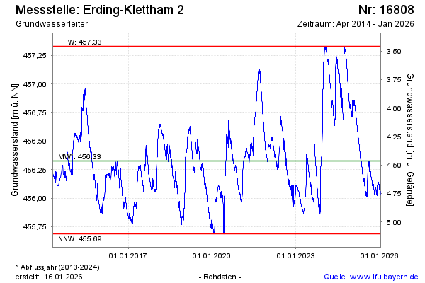
Groundwater level [m above sealevel]: 456.84
Distance to surface [m]: 3.95
Last value from 27.11.2024 09:00
Ground level [m above sealevel]: 460.79
| Date | Groundwater level [m above sealevel] |
|---|---|
| 27.11.2024 | 456.84 |
| 26.11.2024 | 456.84 |
| 25.11.2024 | 456.85 |
| 24.11.2024 | 456.86 |
| 23.11.2024 | 456.87 |
| 22.11.2024 | 456.88 |
| 21.11.2024 | 456.90 |
| 20.11.2024 | 456.91 |
© Bayerisches Landesamt für Umwelt 2024