
- Start >
- Groundwater >
- Waterlevel of upper layer >
- Isar >
- FORSTSTRASSE KO 40 >
- Chart of total period

Chart of total period FORSTSTRASSE KO 40
Groundwater levels of the total period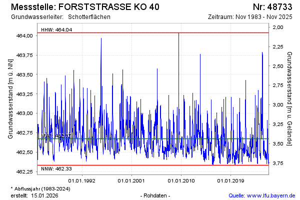
Groundwater level [m above sealevel]: 462.47
Distance to surface [m]: 3.64
Last value from 19.02.2025 11:13
Ground level [m above sealevel]: 466.11
| Date | Groundwater level [m above sealevel] |
|---|---|
| 19.02.2025 | 462.45 |
| 18.02.2025 | 462.46 |
| 17.02.2025 | 462.46 |
| 16.02.2025 | 462.46 |
| 15.02.2025 | 462.47 |
| 14.02.2025 | 462.47 |
| 13.02.2025 | 462.47 |
| 12.02.2025 | 462.47 |
© Bayerisches Landesamt für Umwelt 2025