
- Start >
- Groundwater >
- Waterlevel of upper layer >
- Isar >
- Fürhaupt-WS-7844 >
- Chart of total period

Chart of total period Fürhaupt-WS-7844
Groundwater levels of the total period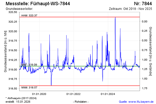
Groundwater level [m above sealevel]: 319.08
Distance to surface [m]: 1.18
Last value from 05.09.2024 10:30
Ground level [m above sealevel]: 320.26
| Date | Groundwater level [m above sealevel] |
|---|---|
| 05.09.2024 | 319.08 |
| 04.09.2024 | 319.08 |
| 03.09.2024 | 319.08 |
| 02.09.2024 | 319.08 |
| 01.09.2024 | 319.08 |
| 31.08.2024 | 319.08 |
| 30.08.2024 | 319.09 |
| 29.08.2024 | 319.09 |
© Bayerisches Landesamt für Umwelt 2024