
- Start >
- Groundwater >
- Waterlevel of upper layer >
- Isar >
- GERMERING HSNR 46 285B >
- Chart of total period

Chart of total period GERMERING HSNR 46 285B
Groundwater levels of the total period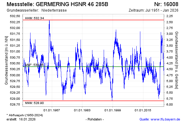
Groundwater level [m above sealevel]: 531.30
Distance to surface [m]: 3.30
Last value from 24.11.2024 09:00
Ground level [m above sealevel]: 534.60
| Date | Groundwater level [m above sealevel] |
|---|---|
| 24.11.2024 | 531.30 |
| 23.11.2024 | 531.30 |
| 22.11.2024 | 531.30 |
| 21.11.2024 | 531.30 |
| 20.11.2024 | 531.29 |
| 19.11.2024 | 531.26 |
| 18.11.2024 | 531.25 |
| 17.11.2024 | 531.25 |
© Bayerisches Landesamt für Umwelt 2024