
- Start >
- Groundwater >
- Waterlevel of upper layer >
- Isar >
- GRASWANG 831 >
- Chart of total period

Chart of total period GRASWANG 831
Groundwater levels of the total period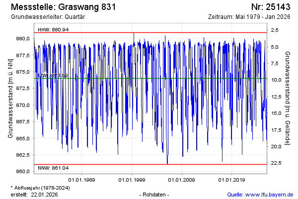
Groundwater level [m above sealevel]: 868.42
Distance to surface [m]: 15.35
Last value from 02.12.2024 21:00
Ground level [m above sealevel]: 883.77
| Date | Groundwater level [m above sealevel] |
|---|---|
| 02.12.2024 | 868.44 |
| 01.12.2024 | 868.47 |
| 30.11.2024 | 868.50 |
| 29.11.2024 | 868.55 |
| 28.11.2024 | 868.63 |
| 27.11.2024 | 868.74 |
| 26.11.2024 | 868.88 |
| 25.11.2024 | 869.04 |
© Bayerisches Landesamt für Umwelt 2024