
- Start >
- Groundwater >
- Waterlevel of upper layer >
- Isar >
- HINTERSEE 765 >
- Current data

Current data HINTERSEE 765
Groundwater levels of the last 12 months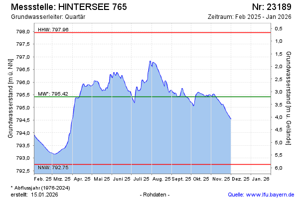
Groundwater level [m above sealevel]: 793.84
Distance to surface [m]: 4.78
Last value from 03.02.2025 09:00
Ground level [m above sealevel]: 798.62
| Date | Groundwater level [m above sealevel] |
|---|---|
| 03.02.2025 | 793.84 |
| 02.02.2025 | 793.87 |
| 01.02.2025 | 793.91 |
| 31.01.2025 | 793.96 |
| 30.01.2025 | 794.01 |
| 29.01.2025 | 794.06 |
| 28.01.2025 | 794.10 |
| 27.01.2025 | 794.14 |
© Bayerisches Landesamt für Umwelt 2025