
- Start >
- Groundwater >
- Waterlevel of upper layer >
- Isar >
- MUENSTERER - A 16 >
- Chart of total period

Chart of total period MUENSTERER - A 16
Groundwater levels of the total period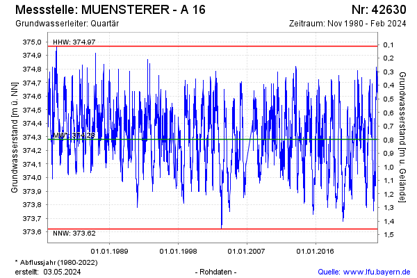
Groundwater level [m above sealevel]: 374.47
Distance to surface [m]: 0.61
Last value from 23.01.2025 14:10
Ground level [m above sealevel]: 375.08
| Date | Groundwater level [m above sealevel] |
|---|---|
| 23.01.2025 | 374.47 |
| 22.01.2025 | 374.48 |
| 21.01.2025 | 374.48 |
| 20.01.2025 | 374.50 |
| 19.01.2025 | 374.51 |
| 18.01.2025 | 374.53 |
| 17.01.2025 | 374.53 |
| 16.01.2025 | 374.54 |
© Bayerisches Landesamt für Umwelt 2025