
- Start >
- Groundwater >
- Waterlevel of upper layer >
- Isar >
- Niederpoering B 97 >
- Current data

Current data Niederpoering B 97
Groundwater levels of the last 12 months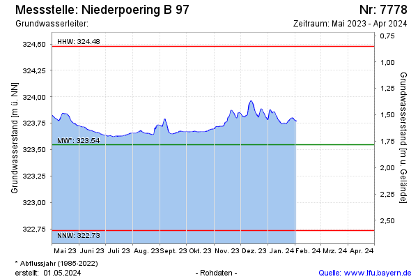
Groundwater level [m above sealevel]: 323.71
Distance to surface [m]: 1.62
Last value from 03.09.2024 10:20
Ground level [m above sealevel]: 325.33
| Date | Groundwater level [m above sealevel] |
|---|---|
| 03.09.2024 | 323.71 |
| 02.09.2024 | 323.71 |
| 01.09.2024 | 323.71 |
| 31.08.2024 | 323.71 |
| 30.08.2024 | 323.71 |
| 29.08.2024 | 323.71 |
| 28.08.2024 | 323.71 |
| 27.08.2024 | 323.71 |
© Bayerisches Landesamt für Umwelt 2024