
- Start >
- Groundwater >
- Waterlevel of upper layer >
- Isar >
- PLOSSAU >
- Chart of total period

Chart of total period PLOSSAU
Groundwater levels of the total period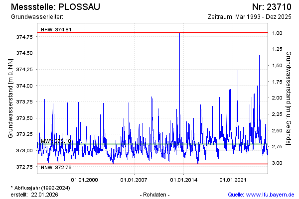
Groundwater level [m above sealevel]: 373.03
Distance to surface [m]: 2.78
Last value from 04.02.2025 13:32
Ground level [m above sealevel]: 375.81
| Date | Groundwater level [m above sealevel] |
|---|---|
| 04.02.2025 | 373.03 |
| 03.02.2025 | 373.04 |
| 02.02.2025 | 373.04 |
| 01.02.2025 | 373.05 |
| 31.01.2025 | 373.05 |
| 30.01.2025 | 373.05 |
| 29.01.2025 | 373.05 |
| 28.01.2025 | 373.04 |
© Bayerisches Landesamt für Umwelt 2025