
- Start >
- Groundwater >
- Waterlevel of upper layer >
- Isar >
- SCHACHTNER - A 11A >
- Chart of total period

Chart of total period SCHACHTNER - A 11A
Groundwater levels of the total period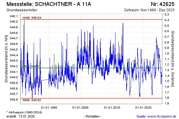
Groundwater level [m above sealevel]: 344.35
Distance to surface [m]: 1.08
Last value from 04.02.2025 14:35
Ground level [m above sealevel]: 345.43
| Date | Groundwater level [m above sealevel] |
|---|---|
| 04.02.2025 | 344.35 |
| 03.02.2025 | 344.35 |
| 02.02.2025 | 344.36 |
| 01.02.2025 | 344.36 |
| 31.01.2025 | 344.36 |
| 30.01.2025 | 344.37 |
| 29.01.2025 | 344.37 |
| 28.01.2025 | 344.36 |
© Bayerisches Landesamt für Umwelt 2025