
- Start >
- Groundwater >
- Waterlevel of upper layer >
- Isar >
- UNTERLENGHART 94 >
- Current data

Current data UNTERLENGHART 94
Groundwater levels of the last 12 months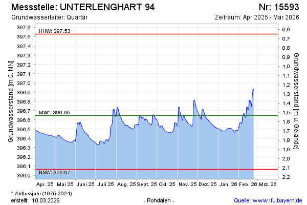
Groundwater level [m above sealevel]: 396.73
Distance to surface [m]: 1.45
Last value from 24.10.2024 12:20
Ground level [m above sealevel]: 398.18
| Date | Groundwater level [m above sealevel] |
|---|---|
| 24.10.2024 | 396.73 |
| 23.10.2024 | 396.72 |
| 22.10.2024 | 396.69 |
| 21.10.2024 | 396.69 |
| 20.10.2024 | 396.70 |
| 19.10.2024 | 396.71 |
| 18.10.2024 | 396.72 |
| 17.10.2024 | 396.72 |
© Bayerisches Landesamt für Umwelt 2024