
- Start >
- Groundwater >
- Waterlevel of upper layer >
- Isar >
- UNTERSCHLEISSHEIM/RATH >
- Year chart of precipitation

Year chart of precipitation UNTERSCHLEISSHEIM/RATH
Groundwater levels of the last 12 months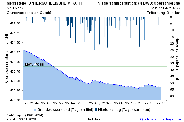
Groundwater level [m above sealevel]: 471,54
Distance to surface [m]: 4,17
Last value from 27.11.2024 10:00
Ground level [m above sealevel]: 475.71
© Bayerisches Landesamt für Umwelt 2024