
- Start >
- Groundwater >
- Waterlevel of upper layer >
- Isar >
- WILLING TANNENW.10 49 >
- Current data

Current data WILLING TANNENW.10 49
Groundwater levels of the last 12 months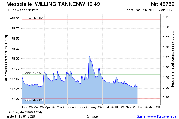
Groundwater level [m above sealevel]: 477.43
Distance to surface [m]: 1.85
Last value from 05.02.2025 13:12
Ground level [m above sealevel]: 479.28
| Date | Groundwater level [m above sealevel] |
|---|---|
| 05.02.2025 | 477.42 |
| 04.02.2025 | 477.44 |
| 03.02.2025 | 477.47 |
| 02.02.2025 | 477.50 |
| 01.02.2025 | 477.53 |
| 31.01.2025 | 477.50 |
| 30.01.2025 | 477.52 |
| 29.01.2025 | 477.58 |
© Bayerisches Landesamt für Umwelt 2025