
- Start >
- Groundwater >
- Waterlevel of upper layer >
- Obere Donau >
- Allach 289A >
- Chart of total period

Chart of total period Allach 289A
Groundwater levels of the total period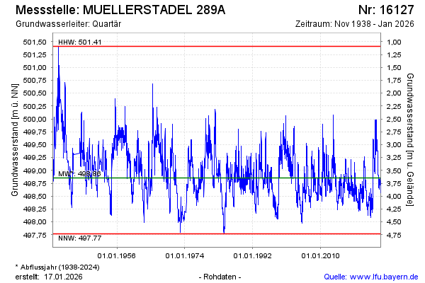
Groundwater level [m above sealevel]: 499.40
Distance to surface [m]: 3.10
Last value from 24.12.2024 10:00
Ground level [m above sealevel]: 502.50
| Date | Groundwater level [m above sealevel] |
|---|---|
| 24.12.2024 | 499.40 |
| 23.12.2024 | 499.40 |
| 22.12.2024 | 499.39 |
| 21.12.2024 | 499.39 |
| 20.12.2024 | 499.39 |
| 19.12.2024 | 499.40 |
| 18.12.2024 | 499.41 |
| 17.12.2024 | 499.41 |
© Bayerisches Landesamt für Umwelt 2024