
- Start >
- Groundwater >
- Waterlevel of upper layer >
- Obere Donau >
- Ansbach HW GWM 2 >
- Chart of total period

Chart of total period Ansbach HW GWM 2
Groundwater levels of the total period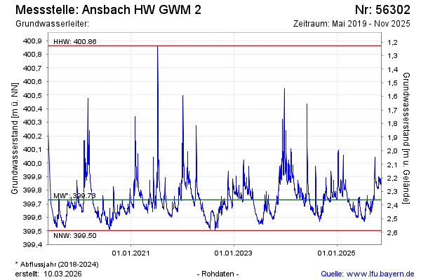
Groundwater level [m above sealevel]: 399.75
Distance to surface [m]: 2.30
Last value from 11.02.2025 11:41
Ground level [m above sealevel]: 402.05
| Date | Groundwater level [m above sealevel] |
|---|---|
| 31.12.2024 | 399.73 |
| 30.12.2024 | 399.73 |
| 29.12.2024 | 399.74 |
| 28.12.2024 | 399.74 |
| 27.12.2024 | 399.74 |
| 26.12.2024 | 399.74 |
| 25.12.2024 | 399.75 |
| 24.12.2024 | 399.76 |
© Bayerisches Landesamt für Umwelt 2025