
- Start >
- Groundwater >
- Waterlevel of upper layer >
- Obere Donau >
- Auernheim >
- Chart of total period

Chart of total period Auernheim
Groundwater levels of the total period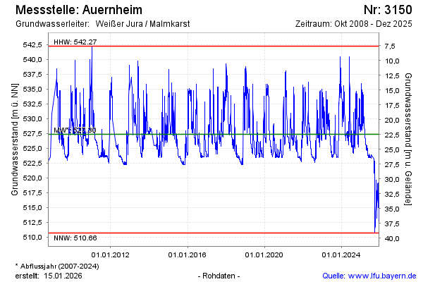
Groundwater level [m above sealevel]: 525.53
Distance to surface [m]: 24.27
Last value from 13.11.2024 12:00
Ground level [m above sealevel]: 549.80
| Date | Groundwater level [m above sealevel] |
|---|---|
| 13.11.2024 | 525.55 |
| 12.11.2024 | 525.66 |
| 11.11.2024 | 525.65 |
| 10.11.2024 | 525.73 |
| 09.11.2024 | 525.83 |
| 08.11.2024 | 525.93 |
| 07.11.2024 | 526.02 |
| 06.11.2024 | 526.14 |
© Bayerisches Landesamt für Umwelt 2024