
- Start >
- Groundwater >
- Waterlevel of upper layer >
- Obere Donau >
- Burgoberbach >
- Current data

Current data Burgoberbach
Groundwater levels of the last 12 months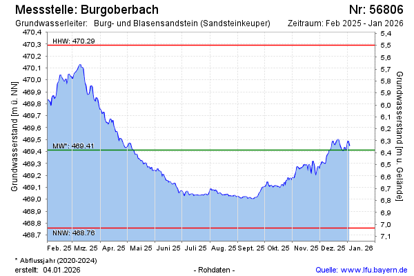
Groundwater level [m above sealevel]: 469.40
Distance to surface [m]: 6.39
Last value from 27.12.2025 13:00
Ground level [m above sealevel]: 475.79
| Date | Groundwater level [m above sealevel] |
|---|---|
| 27.12.2025 | 469.40 |
| 26.12.2025 | 469.41 |
| 25.12.2025 | 469.42 |
| 24.12.2025 | 469.44 |
| 23.12.2025 | 469.47 |
| 22.12.2025 | 469.50 |
| 21.12.2025 | 469.50 |
| 20.12.2025 | 469.48 |
© Bayerisches Landesamt für Umwelt 2025