
- Start >
- Groundwater >
- Waterlevel of upper layer >
- Obere Donau >
- Erding HWS-NW1 >
- Chart of total period

Chart of total period Erding HWS-NW1
Groundwater levels of the total period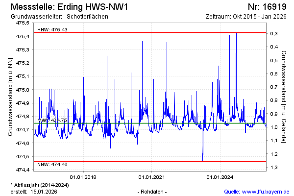
Groundwater level [m above sealevel]: 474.74
Distance to surface [m]: 0.98
Last value from 13.03.2025 10:00
Ground level [m above sealevel]: 475.72
| Date | Groundwater level [m above sealevel] |
|---|---|
| 13.03.2025 | 474.74 |
| 12.03.2025 | 474.73 |
| 11.03.2025 | 474.73 |
| 10.03.2025 | 474.73 |
| 09.03.2025 | 474.73 |
| 08.03.2025 | 474.73 |
| 07.03.2025 | 474.73 |
| 06.03.2025 | 474.74 |
© Bayerisches Landesamt für Umwelt 2025