
- Start >
- Groundwater >
- Waterlevel of upper layer >
- Obere Donau >
- GUN_HW_KB 4 >
- Current data

Current data GUN_HW_KB 4
Groundwater levels of the last 12 months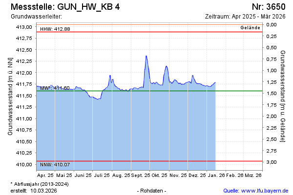
Groundwater level [m above sealevel]: 411.94
Distance to surface [m]: 1.11
Last value from 23.01.2025 11:37
Ground level [m above sealevel]: 413.05
| Date | Groundwater level [m above sealevel] |
|---|---|
| 23.01.2025 | 411.97 |
| 22.01.2025 | 412.02 |
| 21.01.2025 | 412.06 |
| 20.01.2025 | 412.12 |
| 19.01.2025 | 412.17 |
| 18.01.2025 | 412.22 |
| 17.01.2025 | 412.26 |
| 16.01.2025 | 412.32 |
© Bayerisches Landesamt für Umwelt 2025