
- Start >
- Groundwater >
- Waterlevel of upper layer >
- Obere Donau >
- GUN_ReNat_1 >
- Chart of total period

Chart of total period GUN_ReNat_1
Groundwater levels of the total period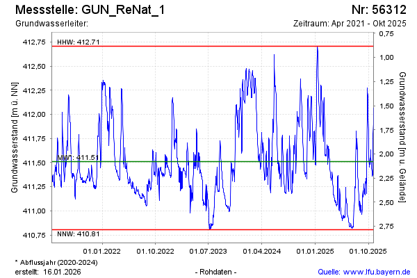
Groundwater level [m above sealevel]: 411.75
Distance to surface [m]: 1.84
Last value from 18.09.2024 11:20
Ground level [m above sealevel]: 413.59
| Date | Groundwater level [m above sealevel] |
|---|---|
| 18.09.2024 | 411.78 |
| 17.09.2024 | 411.78 |
| 16.09.2024 | 411.63 |
| 15.09.2024 | 411.59 |
| 14.09.2024 | 411.63 |
| 13.09.2024 | 411.65 |
| 12.09.2024 | 411.68 |
| 11.09.2024 | 411.64 |
© Bayerisches Landesamt für Umwelt 2024