
- Start >
- Groundwater >
- Waterlevel of upper layer >
- Obere Donau >
- Herrieden >
- Current data

Current data Herrieden
Groundwater levels of the last 12 months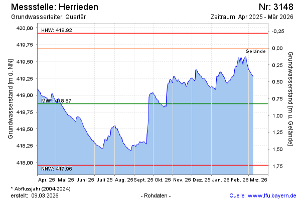
Groundwater level [m above sealevel]: 419.46
Distance to surface [m]: 0.24
Last value from 15.02.2025 13:00
Ground level [m above sealevel]: 419.70
| Date | Groundwater level [m above sealevel] |
|---|---|
| 15.02.2025 | 419.47 |
| 14.02.2025 | 419.50 |
| 13.02.2025 | 419.56 |
| 12.02.2025 | 419.49 |
| 11.02.2025 | 419.37 |
| 10.02.2025 | 419.33 |
| 09.02.2025 | 419.32 |
| 08.02.2025 | 419.34 |
© Bayerisches Landesamt für Umwelt 2025