
- Start >
- Groundwater >
- Waterlevel of upper layer >
- Obere Donau >
- Langenaltheim >
- Current data

Current data Langenaltheim
Groundwater levels of the last 12 months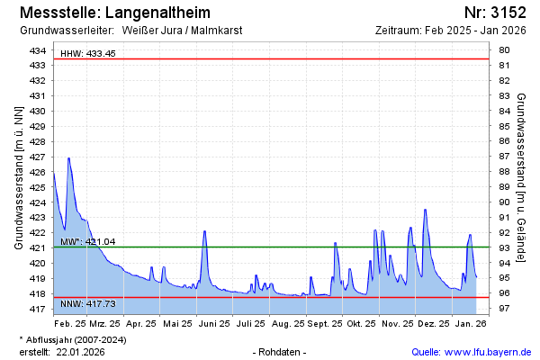
Groundwater level [m above sealevel]: 425.84
Distance to surface [m]: 88.19
Last value from 13.01.2025 13:00
Ground level [m above sealevel]: 514.03
| Date | Groundwater level [m above sealevel] |
|---|---|
| 13.01.2025 | 425.97 |
| 12.01.2025 | 426.36 |
| 11.01.2025 | 427.01 |
| 10.01.2025 | 427.48 |
| 09.01.2025 | 426.19 |
| 08.01.2025 | 425.27 |
| 07.01.2025 | 424.91 |
| 06.01.2025 | 423.92 |
© Bayerisches Landesamt für Umwelt 2025