
- Start >
- Groundwater >
- Waterlevel of upper layer >
- Obere Donau >
- MOERSLINGEN D 44 >
- Current data

Current data MOERSLINGEN D 44
Groundwater levels of the last 12 months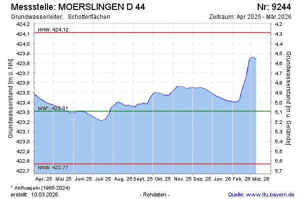
Groundwater level [m above sealevel]: 423.46
Distance to surface [m]: 4.94
Last value from 26.12.2024 10:00
Ground level [m above sealevel]: 428.40
| Date | Groundwater level [m above sealevel] |
|---|---|
| 26.12.2024 | 423.46 |
| 25.12.2024 | 423.46 |
| 24.12.2024 | 423.46 |
| 23.12.2024 | 423.46 |
| 22.12.2024 | 423.46 |
| 21.12.2024 | 423.46 |
| 20.12.2024 | 423.46 |
| 19.12.2024 | 423.47 |
© Bayerisches Landesamt für Umwelt 2024