
- Start >
- Groundwater >
- Waterlevel of upper layer >
- Obere Donau >
- Rohrbach GW3 >
- Chart of total period

Chart of total period Rohrbach GW3
Groundwater levels of the total period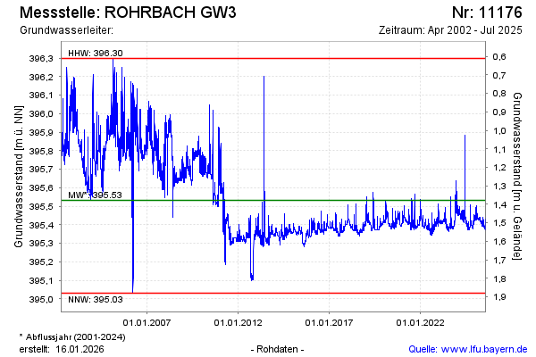
Groundwater level [m above sealevel]: 395.43
Distance to surface [m]: 1.48
Last value from 05.12.2024 12:00
Ground level [m above sealevel]: 396.91
| Date | Groundwater level [m above sealevel] |
|---|---|
| 05.12.2024 | 395.42 |
| 04.12.2024 | 395.42 |
| 03.12.2024 | 395.43 |
| 02.12.2024 | 395.41 |
| 01.12.2024 | 395.41 |
| 30.11.2024 | 395.41 |
| 29.11.2024 | 395.41 |
| 28.11.2024 | 395.42 |
© Bayerisches Landesamt für Umwelt 2025