
- Start >
- Groundwater >
- Waterlevel of upper layer >
- Obere Donau >
- TAPFHEIM 40A >
- Chart of total period

Chart of total period TAPFHEIM 40A
Groundwater levels of the total period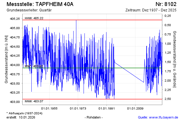
Groundwater level [m above sealevel]: 404.25
Distance to surface [m]: 1.33
Last value from 17.12.2024 16:11
Ground level [m above sealevel]: 405.58
| Date | Groundwater level [m above sealevel] |
|---|---|
| 17.12.2024 | 404.25 |
| 16.12.2024 | 404.27 |
| 15.12.2024 | 404.30 |
| 14.12.2024 | 404.34 |
| 13.12.2024 | 404.36 |
| 12.12.2024 | 404.39 |
| 11.12.2024 | 404.43 |
| 10.12.2024 | 404.47 |
© Bayerisches Landesamt für Umwelt 2024