
- Start >
- Groundwater >
- Waterlevel of upper layer >
- Obere Donau >
- Wassertrüdingen HW GWM 2 >
- Current data

Current data Wassertrüdingen HW GWM 2
Groundwater levels of the last 12 months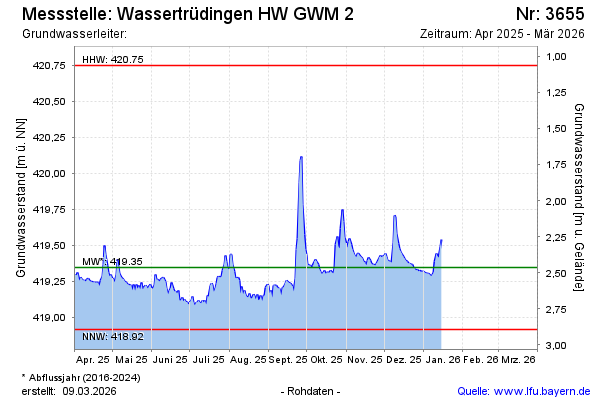
Groundwater level [m above sealevel]: 419.29
Distance to surface [m]: 2.48
Last value from 02.04.2025 14:14
Ground level [m above sealevel]: 421.77
Date | Groundwater level [m above sealevel] |
|---|---|
| 02.04.2025 | 419.30 |
| 01.04.2025 | 419.28 |
| 31.03.2025 | 419.31 |
| 30.03.2025 | 419.34 |
| 29.03.2025 | 419.34 |
| 28.03.2025 | 419.35 |
| 27.03.2025 | 419.37 |
| 26.03.2025 | 419.39 |
© Bayerisches Landesamt für Umwelt 2025