
- Start >
- Groundwater >
- Waterlevel of upper layer >
- Obere Donau >
- Wilburgstetten GM 5A F >
- Chart of total period

Chart of total period Wilburgstetten GM 5A F
Groundwater levels of the total period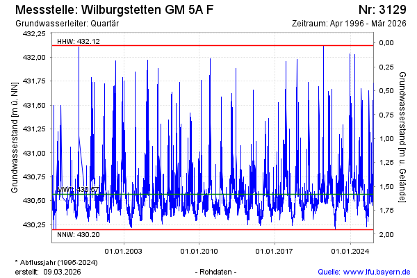
Groundwater level [m above sealevel]: 430.98
Distance to surface [m]: 1.17
Last value from 16.02.2025 13:00
Ground level [m above sealevel]: 432.15
| Date | Groundwater level [m above sealevel] |
|---|---|
| 16.02.2025 | 431.03 |
| 15.02.2025 | 431.26 |
| 14.02.2025 | 431.55 |
| 13.02.2025 | 431.26 |
| 12.02.2025 | 430.84 |
| 11.02.2025 | 430.66 |
| 10.02.2025 | 430.61 |
| 09.02.2025 | 430.62 |
© Bayerisches Landesamt für Umwelt 2025