
- Start >
- Groundwater >
- Waterlevel of upper layer >
- Obere Donau >
- Wolnzach T2 >
- Current data

Current data Wolnzach T2
Groundwater levels of the last 12 months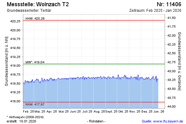
Groundwater level [m above sealevel]: 418.36
Distance to surface [m]: 43.49
Last value from 22.11.2024 10:00
Ground level [m above sealevel]: 461.85
| Date | Groundwater level [m above sealevel] |
|---|---|
| 22.11.2024 | 418.41 |
| 21.11.2024 | 418.44 |
| 20.11.2024 | 418.43 |
| 19.11.2024 | 418.49 |
| 18.11.2024 | 418.43 |
| 17.11.2024 | 418.45 |
| 16.11.2024 | 418.44 |
| 15.11.2024 | 418.41 |
© Bayerisches Landesamt für Umwelt 2024