
- Start >
- Groundwater >
- Waterlevel of upper layer >
- Unterer Main >
- Heinrichsthal S 7 >
- Current data

Current data Heinrichsthal S 7
Groundwater levels of the last 12 months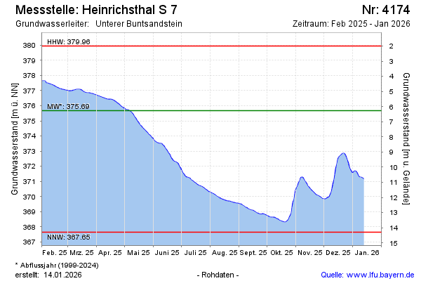
Groundwater level [m above sealevel]: 377.35
Distance to surface [m]: 4.67
Last value from 16.02.2025 09:00
Ground level [m above sealevel]: 382.02
| Date | Groundwater level [m above sealevel] |
|---|---|
| 16.02.2025 | 377.35 |
| 15.02.2025 | 377.37 |
| 14.02.2025 | 377.40 |
| 13.02.2025 | 377.44 |
| 12.02.2025 | 377.47 |
| 11.02.2025 | 377.49 |
| 10.02.2025 | 377.51 |
| 09.02.2025 | 377.53 |
© Bayerisches Landesamt für Umwelt 2025