
- Start >
- Groundwater >
- Waterlevel of upper layer >
- Unterer Main >
- Mühlfeld Mu11 >
- Current data

Current data Mühlfeld Mu11
Groundwater levels of the last 12 months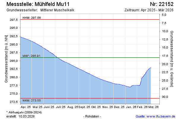
Groundwater level [m above sealevel]: 292.20
Distance to surface [m]: 11.82
Last value from 16.02.2025 10:00
Ground level [m above sealevel]: 304.02
| Date | Groundwater level [m above sealevel] |
|---|---|
| 16.02.2025 | 292.21 |
| 15.02.2025 | 292.17 |
| 14.02.2025 | 292.13 |
| 13.02.2025 | 292.11 |
| 12.02.2025 | 292.05 |
| 11.02.2025 | 291.99 |
| 10.02.2025 | 291.92 |
| 09.02.2025 | 291.85 |
© Bayerisches Landesamt für Umwelt 2025