
- Start >
- Groundwater >
- Waterlevel of upper layer >
- Naab - Regen >
- Hub >
- Current data

Current data Hub
Groundwater levels of the last 12 months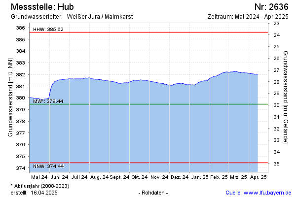
Groundwater level [m above sealevel]: 381.22
Distance to surface [m]: 28.16
Last value from 13.01.2025 09:36
Ground level [m above sealevel]: 409.38
| Date | Groundwater level [m above sealevel] |
|---|---|
| 13.01.2025 | 381.21 |
| 12.01.2025 | 381.19 |
| 11.01.2025 | 381.16 |
| 10.01.2025 | 381.11 |
| 09.01.2025 | 381.08 |
| 08.01.2025 | 381.06 |
| 07.01.2025 | 381.07 |
| 06.01.2025 | 381.09 |
© Bayerisches Landesamt für Umwelt 2025