
- Start >
- Groundwater >
- Waterlevel of upper layer >
- Naab - Regen >
- OBERAMMERSRICHT B2 >
- Current data

Current data OBERAMMERSRICHT B2
Groundwater levels of the last 12 months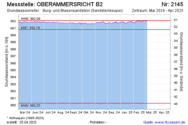
Groundwater level [m above sealevel]: 391.96
Distance to surface [m]: 31.24
Last value from 06.03.2025 09:27
Ground level [m above sealevel]: 423.20
Date | Groundwater level [m above sealevel] |
|---|---|
| 06.03.2025 | 391.97 |
| 05.03.2025 | 391.96 |
| 04.03.2025 | 392.02 |
| 03.03.2025 | 391.99 |
| 02.03.2025 | 391.96 |
| 01.03.2025 | 391.99 |
| 28.02.2025 | 392.05 |
| 27.02.2025 | 392.09 |
© Bayerisches Landesamt für Umwelt 2025