
- Start >
- Groundwater >
- Waterlevel of upper layer >
- Untere Donau >
- BEHRHOF - A 13 >
- Current data

Current data BEHRHOF - A 13
Groundwater levels of the last 12 months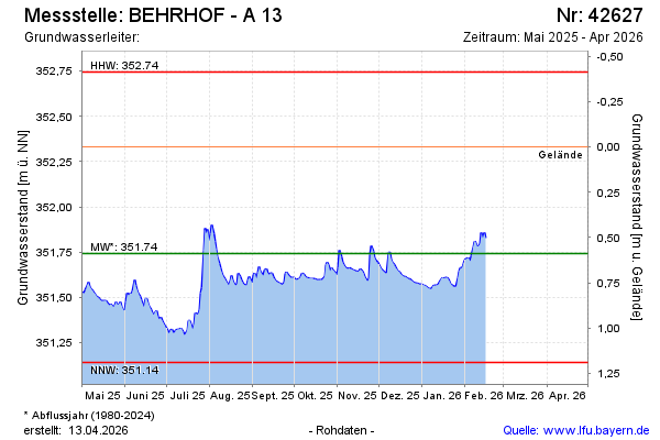
Groundwater level [m above sealevel]: 351.76
Distance to surface [m]: 0.57
Last value from 04.02.2025 14:10
Ground level [m above sealevel]: 352.33
| Date | Groundwater level [m above sealevel] |
|---|---|
| 04.02.2025 | 351.76 |
| 03.02.2025 | 351.78 |
| 02.02.2025 | 351.80 |
| 01.02.2025 | 351.84 |
| 31.01.2025 | 351.88 |
| 30.01.2025 | 351.91 |
| 29.01.2025 | 351.98 |
| 28.01.2025 | 351.92 |
© Bayerisches Landesamt für Umwelt 2025