
- Start >
- Groundwater >
- Waterlevel of upper layer >
- Untere Donau >
- Flussraummanagement Vils, MQS 12-L (ML12) >
- Year chart of precipitation

Year chart of precipitation Flussraummanagement Vils, MQS 12-L (ML12)
Groundwater levels of the last 12 months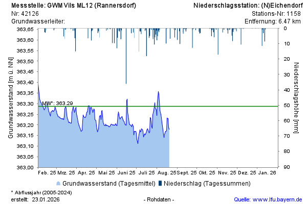
Groundwater level [m above sealevel]: 363,28
Distance to surface [m]: 2,52
Last value from 25.11.2024 11:45
Ground level [m above sealevel]: 365.80
© Bayerisches Landesamt für Umwelt 2025