
- Start >
- Groundwater >
- Waterlevel of upper layer >
- Untere Donau >
- FORSTERN/MOOS >
- Chart of total period

Chart of total period FORSTERN/MOOS
Groundwater levels of the total period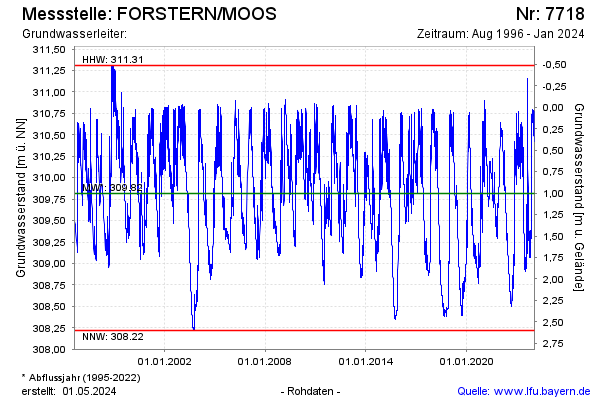
note
GW Messstelle im SN SKS Pielweichs
Groundwater level [m above sealevel]: 310.32
Distance to surface [m]: 0.50
Last value from 17.01.2025 09:35
Ground level [m above sealevel]: 310.82
| Date | Groundwater level [m above sealevel] |
|---|---|
| 31.12.2024 | 310.33 |
| 30.12.2024 | 310.37 |
| 29.12.2024 | 310.42 |
| 28.12.2024 | 310.48 |
| 27.12.2024 | 310.55 |
| 26.12.2024 | 310.62 |
| 25.12.2024 | 310.66 |
| 24.12.2024 | 310.71 |
© Bayerisches Landesamt für Umwelt 2025