
- Start >
- Groundwater >
- Waterlevel of upper layer >
- Untere Donau >
- HORNSTORF L 101 >
- Chart of total period

Chart of total period HORNSTORF L 101
Groundwater levels of the total period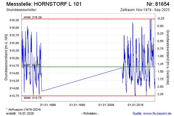
Groundwater level [m above sealevel]: 315.31
Distance to surface [m]: 0.75
Last value from 17.02.2025 06:00
Ground level [m above sealevel]: 316.06
| Date | Groundwater level [m above sealevel] |
|---|---|
| 31.12.2024 | 315.09 |
| 30.12.2024 | 315.11 |
| 29.12.2024 | 315.13 |
| 28.12.2024 | 315.15 |
| 27.12.2024 | 315.16 |
| 26.12.2024 | 315.15 |
| 25.12.2024 | 315.14 |
| 24.12.2024 | 315.14 |
© Bayerisches Landesamt für Umwelt 2025