
- Start >
- Groundwater >
- Waterlevel of upper layer >
- Untere Donau >
- HORNSTORF N6 >
- Current data

Current data HORNSTORF N6
Groundwater levels of the last 12 months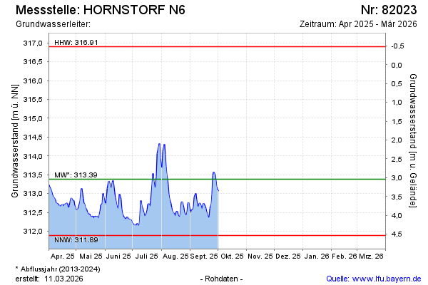
note
GW Messstelle im SN Öberauer Schleife
Groundwater level [m above sealevel]: 312.87
Distance to surface [m]: 3.55
Last value from 12.11.2024 00:00
Ground level [m above sealevel]: 316.42
| Date | Groundwater level [m above sealevel] |
|---|---|
| 07.08.2024 | 313.40 |
| 06.08.2024 | 313.52 |
| 05.08.2024 | 313.65 |
| 04.08.2024 | 313.70 |
| 03.08.2024 | 313.65 |
| 02.08.2024 | 313.58 |
| 01.08.2024 | 313.26 |
| 31.07.2024 | 313.32 |
© Bayerisches Landesamt für Umwelt 2024