
- Start >
- Groundwater >
- Waterlevel of upper layer >
- Untere Donau >
- Innerhienthal N33 >
- Current data

Current data Innerhienthal N33
Groundwater levels of the last 12 months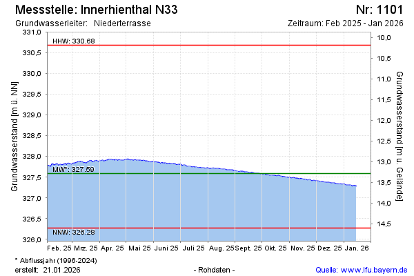
Groundwater level [m above sealevel]: 327.73
Distance to surface [m]: 13.14
Last value from 13.01.2025 08:00
Ground level [m above sealevel]: 340.87
| Date | Groundwater level [m above sealevel] |
|---|---|
| 13.01.2025 | 327.73 |
| 12.01.2025 | 327.73 |
| 11.01.2025 | 327.75 |
| 10.01.2025 | 327.75 |
| 09.01.2025 | 327.79 |
| 08.01.2025 | 327.79 |
| 07.01.2025 | 327.77 |
| 06.01.2025 | 327.80 |
© Bayerisches Landesamt für Umwelt 2025