
- Start >
- Groundwater >
- Waterlevel of upper layer >
- Untere Donau >
- Isarvorland P4 >
- Current data

Current data Isarvorland P4
Groundwater levels of the last 12 months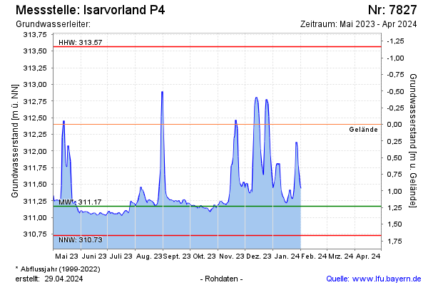
note
GW Messstelle im SN Isarvorland
Groundwater level [m above sealevel]: 311.20
Distance to surface [m]: 1.20
Last value from 14.11.2024 09:30
Ground level [m above sealevel]: 312.40
| Date | Groundwater level [m above sealevel] |
|---|---|
| 14.11.2024 | 311.21 |
| 13.11.2024 | 311.21 |
| 12.11.2024 | 311.22 |
| 11.11.2024 | 311.22 |
| 10.11.2024 | 311.25 |
| 09.11.2024 | 311.27 |
| 08.11.2024 | 311.28 |
| 07.11.2024 | 311.28 |
© Bayerisches Landesamt für Umwelt 2024